The purpose of the ICI inversion system is to reconstitute the vertical structure of the atmosphere in terms of temperature and moisture by inverting the radiative transfer equation. This is done by processing observations of sounder radiometers collected by an HRPT local station for the NOAA orbiting satellites.
| main funtions | on-line documentation | references |
The ICI system reads AAPP level1d TOVS/ATOVS incoming data that are navigated, temperature calibrated, mapped on the HIRS grid and documented after AAPP pre-processing. The maps that are presently being developed are the MSU on the HIRS grid for TOVS and the AMSU-A and AMSU-B on the HIRS grid for ATOVS. The main information associated with each HIRS fov are on the one hand the surface type (land/sea/mixed) and the altitude originating from topographic files and on the other hand the cloud cover and the skin surface temperature originating from the AVHRR cloud mask, and specifically for ATOVS, rainfall surface type flags originating from the AMSU preprocessing.
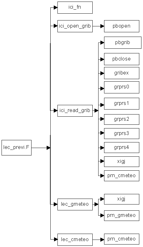
The diagram shows the main functions of the ICI inversion system.
ICI: it the software core. It is activated in 'real
time' just after preprocessing a new acquisition. It reads the observations
file in the level1d format as output of the AAPP preprocesses. It also
reads some surface parameters predicted by a numerical weather prediction
model in ASCII or GRIB format depending on parametrization, computes some
cleared radiances when it is necessary, initializes the inversion by means
of a likely atmospheric profile using ancillaring analysis profiles or
a climatologoly (guess), performs a 1D-Var inversion and writes the inverted
profile into the output file.
The software uses the RTTOV6 fast forward model inside the 1D-Var inversion.
ICI inversion output files are sequential access binary
files with one record per situation containing the level1d incoming data,
environment data, surface weather forecasts, the atmospheric profile used
for initializing the inversion as well as the restituted profile.
Five coding routines can be activated by the parametrization
so as to create the following files according to the user's requirements:
ASCII files, mainly useful for coding colocated files, AAPP level2 standard
files, SATEM, and BUFR format files (for assimilation or monitoring the
numerical weather prediction model) or finally GRIB meteorological standard
files used in particular for their display on the Météo-France
"Synergie" graphic display units.
BASE METEO: the software supplies a local meteorological library comprising radiosoundings, analyses and temperature and moisture forecasts in altitude and on the surface. At the CMS, the library is supplied with information coming from the Météo-France BDM and BDAP. The purpose of BASE_METEO is to provide the ICI core module with forecasts, the BASE_PROFIL with analyses and the MONITORING with radiosoundings and analyses.
BASE_PROFIL: this module creates a library of temperature and moisture atmospheric profiles. Profiles are used for initializing the inversion using a vertical profile which is very close to the restituted profile; they should therefore represent the meteorological situation encountered. The module finds information in the BASE_METEO when the latter is supplied on a regular basis or uses a climatological library (2 climatological libraries are available with ICI). Up and down radiances as well as total satellite-surface transmittances associated with each profile are computed with the RTTOV6 fast forwad model.
MONITORING : the purpose of monitoring is first to adjust the inversion model so as to guarantee quality and stability for restituted profiles on a long-term basis by periodically re-adjusting the internal statistic coefficients of the ICI software (tuning) and second to perform a regular follow-up of quality (validation). Both actions are performed by using colocated data files (colocation) containing the satellite data, the inverted profile, the radiosounding and/or the nearest analysis in time and space.
GRAPHIC DISPLAY: a set of graphic commands (using the freeware GMT library) and fortran codes have been added to the software for the visualization of the retrieved passes and their departure to NWP fields, and for the time display of the error statistics of key parameters (ex: forward RTTOV biases, RMSE of ICI temperature). An http page for putting all together these figures in gif format: it is an easy way for having a general view of the evolution of the software.
The ICI application is very modular through the use of two input permanent files. Their contain can be adjusted so as to meet specific users requirements. They are :
Borbas E., Szenyan, R. Randriamampianina: Current status
for operational processing of TOVS data at the Hungarian Meteorological
Service.
ITSC no10. 1999
Borbas E., R. Randriamampianina, Szenyan: Perpective
on the operational use of TOVS and ATOVS at the Hungarian Service, ITSC11,
2000
Brunel P., L. Lavanant, G. Rochard: Infrared transmittance
data base for radiative transfer model. ITSC no8. 1995
Carvalho J.: Remote sounding over Brazil using the ATOVS
system. PhD thesis part 1. 2001
Lavanant L. , P. Brunel, G. Rochard: TOVS sounding
products at the CMS. The ICI model. IRS'96. 1996
Lavanant L., P. Brunel, G. Rochard, T.Labrot: Noaa15
sounding profiles retrieved with the ICI scheme. ITSC no10. 1999
Lavanant L. , H. LeGleau, M. Derrien, S. Levasseur, G.
Monnier, L.Ardouin, P. Brunel: AVHRR cloud mask for sounding applications.
ITSC no10. 1999
Lavanant L., P. Brunel, G. Rochard, T.Labrot, Wu X.:
ATOVS retrievals for local HRPT. ECMWF/EUMETSAT conference. 1999
Randriamampianina R., L. Lavanant, H. Roquet: The study
of the horizontal structure of the 'SATEM Lannion' data. ITSC no10. 1999
Wu X., L. Lavanant, P. Brunel, W. Zhang, 2000: Using
ICI at the National Satellite Meteorological Center of China, ITSC11, 2000